Fishing in British Honduras 1764
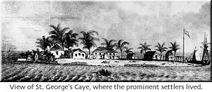
St. George's Caye 1n 1764
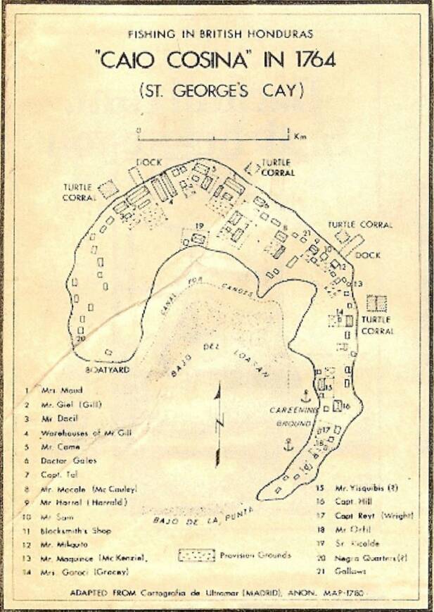
 The cartography is clearly Spanish in origin, and some of the names of persons inhabiting the island at the time are spelled phonetically as they would be by Spaniards trying to write English and Scottish names. But these are not the only interesting things about "Caio Cosina".
The island over two centuries ago was much bigger than it is today. Roughly the shape of a horeshoe and measuring very nearly two miles in length by about one third mile at its widest point.
The Caye supported seventeen families in 1764 along with their slaves. The provision grounds fertile areas of the Caye land where vegetables and ground food could be grown, and the number turtle corrals which served as large storage traps for the live animals, indicate that the island must have been largely self-supporting at the time when Field Marshall O'Neil decide he would like to capture it.
By 1787, there were 62 buildings on the caye.
This interesting map has been extracted from a study by Alan K. Craig for the Louisiana State University of Baton Rouge, entitled "Geography of Fishing in British Honduras and Adjacent Coastal Areas" published on April 15, 1966. The drawing is acknowledge to be the work of a Spaniard, whose name, alias, has been lost to posterity